
Author’s note: This mini-guide uses LiDar measurements. This advanced technology is the most accurate means of measuring elevation. The newness of LiDar-reported heights may differ slightly from existing maps.
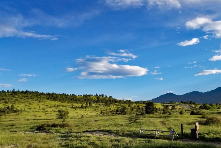
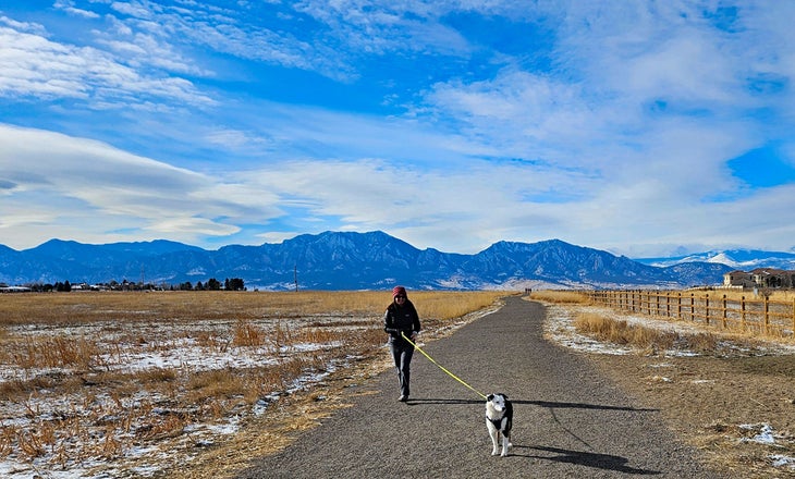
Boulder, Colorado, is a hiker’s paradise. The city sits on the geographic hinge where the Great Plains give way to the Rocky Mountains. Some hiking trails start from town and wander to the tops of 8,000+ foot summits. Less aggressive trails explore rolling meadows and ancient mesas on the city’s east side. Wildlife thrives in shaded, vanilla-scented forests and open grasslands, and clear mountain streams rush down dramatic canyons, flowing into pastoral farmland. Boulder’s varied landscapes and four-season access make it one of the best places in America for hiking adventures.
Jump to: Best Day Hikes in Boulder | Best Big All-Day Hikes | Best Dog Park N’ Hikes in Boulder | Gear, Weather, and Tips for Boulder Hiking
Best Day Hikes in Boulder
Whether you are into peak bagging or bird watching, Boulder’s varied terrain has hikes for a wide range of interests.
|
Hike |
Difficulty | Distance |
Best For |
| Marshall Mesa – Greenbelt Plateau | Easy | 3.6 miles | Amazing views of the Flatirons |
| Green Mountain via Gregory Canyon | Medium | 5.4 miles | Legit summit hike right in town |
| Sawhill Ponds | Easy | 2.0 miles | Peaceful strolls & birdwatching |
| Bear Peak via Fern Canyon | Tough | 5.6 miles | Best summit views |
| Sugarloaf Mountain | Medium | 1.3 miles | Tremendous views and a short hike |
| Mount Sanitas Loop | Medium | 3.9 miles | Classic hike with fine city views |
| Walker Ranch Loop | Medium / Tough | 7.7 miles | Variety of ecosystems and water |
| Doudy Draw to Flatirons Vista | Easy | 7.5 miles | Easy walk with great South Boulder views |
| South Boulder Peak via Shadow Canyon | Tough | 8 miles | Rugged and highest in Boulder Parks system |
| Sage Trail | Easy | 2.8 miles | Quiet North Boulder hiking network |
Marshall Mesa – Greenbelt Plateau
✅ Best “Welcome to Boulder” Hike
► This is my favorite loop at Marshall Mesa. It wanders uphill, slowly reaching the high point along the Greenbelt Plateau. Briefly retrace your steps back to the main loop and finish at the parking lot.
Trailhead Parking: 39.95300, -105.23160
Distance: 3.6 miles
Elevation Gain: 490 feet
Notes: $5 daily / $25 annual fee for non-Boulder residents. Dogs must be leashed or have Boulder’s Voice and Sight tags.
Right click and “save link as” or long press on mobile to download GPX file: Marshall Mesa GPX file
- Easy parking and terrain
- Incredible views of the Flatirons rock formations
- Great network of trails for wandering
No other hike in Boulder captures the magic and majesty of this ancient landscape than Marshall Mesa. Views of Boulder’s iconic Flatiron rock formations are the stars of the show. These towering iron monoliths denote the eastern boundary of the Rocky Mountains in dramatic fashion. Far on the northwest horizon, 14,000-foot Longs Peak stands guard over the high apexes of Rocky Mountain National Park. Boulder Valley shimmers below when viewed from the high meadows atop Greenbelt Plateau.
Community Ditch is a man-made canal carved into the mesa that usually runs until mid-summer before it dries up. It’s reborn each spring and is a great place for your dog to cool off when it’s running. Nearby, Marshall Lake is hidden on the eastern side of the mesa. Though it’s inaccessible to hikers, seeing it from a distance reminds one of a desert oasis. Views to the east go all the way to the Denver metropolis area. Enormous windmills to the south add a touch of “modern marvel” to your adventure.
Hikers can cruise easy trails in less than four miles and take in what makes Boulder so special. Hiking at sunrise or sunset—especially in winter—creates a dreamy atmosphere perfect for photographers chasing Golden Hour snapshots. Marshall Mesa is rich with emotionally moving landscapes, from prehistoric geography to dazzling city lights.

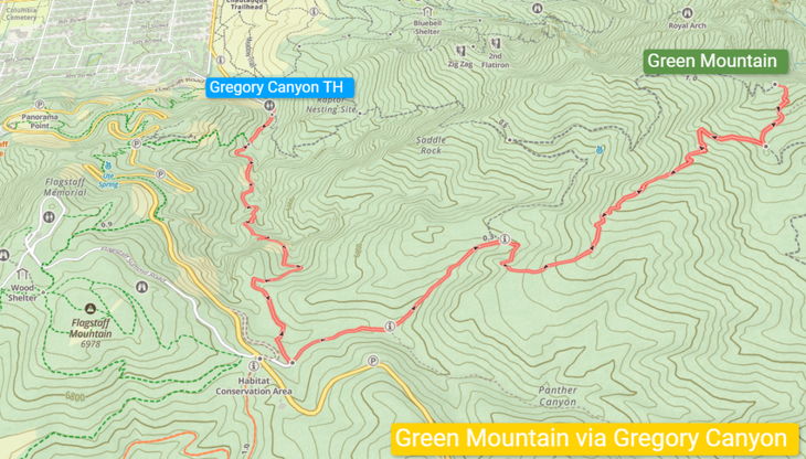
Green Mountain via Gregory Canyon
✅ Best In-Town Summit Hike
► It’s hard to pick my favorite mountain hike, but since I’ve hiked Green Mountain over 100 times, I think that data speaks for itself. It can be hiked year-round, but be sure to bring microspikes during winter’s snowy and icy conditions.
Trailhead Parking: 39.99751, -105.29271
Distance: 5.4 miles out-and-back
Elevation Gain: 2,360 feet
Notes: $5 daily / $25 annual fee for non-Boulder residents. Dogs must be leashed or have Boulder’s Voice and Sight tags.
Download: Green Mountain via Gregory Canyon GPX file
- Legit summit hike right in town
- See the power of Boulder’s 2013 floods
- Fun last push to the iconic summit block
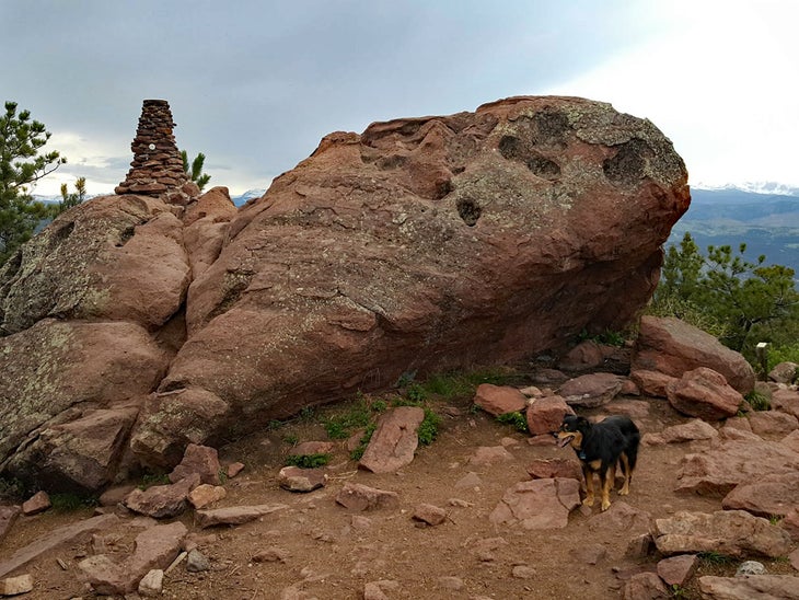
8,144-foot Green Mountain is a true mountain hike. It gains 2,360’ of elevation in 2.7 miles, making it a great 3-5 hour outing. The route featured here starts at Gregory Canyon and follows a small creek before scrambling onto the shoulder of Green Mountain. Destruction from the 2013 Boulder floods will be evident in the exaggerated gash cut along the banks of the tiny stream below.
At 1.2 miles, the Gregory Canyon Trail ends at the Green Mountain Lodge, a stone building still used for events. Take the Ranger Trail and begin a steady-then-steep ascent 0.9 miles to the junction with the Green Mountain West Ridge Trail/E.M. Greenman Trail. Follow the punchy E.M. Greenman Trail 0.2 miles up steep stone steps to the iconic summit block. An easy scramble offers 360-degree views with particularly impressive vistas of the Indian Peaks to the west. The metal sighting disk on the top sort of lines up with peaks along the horizon and does accurately name the sequence of summits.
You will absolutely get a workout on this hike. Though you only spend a blip of time truly above treeline, there are excellent views throughout this adventure. The forests of Green Mountain are home to a host of wildlife, including a few of Boulder’s generally shy black bears (give them space if you see them).
Note: Parking at Gregory Canyon can get very crowded, especially on summer weekends. A nice alternative for busy weekends is to park at the Chapman Drive Trailhead up Boulder Canyon and hike 2.3 miles up the Chapman Drive Trail. This road was converted to a hiking path and deposits you at the Green Mountain Lodge after crossing Flagstaff Road, making for a 9+ mile out-and-back round-trip.
Sawhill Ponds
✅ Best Hike for Peaceful Strolls & Bird Watching
► Sawhill Ponds is the perfect place to slow down, chill out, and take in a hidden side of Boulder. It’s a great place for a conversation with a friend, to take the dogs, or just gaze into the micro-environments in the ponds themselves.
Trailhead Parking: 40.03961, -105.18508
Distance: 2+ miles of interconnected trails
Elevation Gain: 100 feet
Dogs: Must be leashed west of the main parking lot.
Download: Sawhill Ponds GPX file
- Mellow, flat terrain with good handicap access
- Excellent birding
- Change of pace from Boulder’s busy in-town trails
The smattering of pools that make up Sawhill Ponds was once part of a gravel mine. Today, Colorado Parks and Wildlife (CPW) owns the property. It sits quietly on the flat outskirts of east Boulder. Yes, the area is a refuge for birds and other wildlife, but it’s also a nice retreat from the busy, type-A, go-fast-style of many of Boulder’s other trails. While there are occasional runners, the vibe of Sawhill Ponds is to slow down.
I fell in love with this area as my dogs aged out of big mountain hikes. Our walks at Sawhill were a splendor of smells and sounds, perfect for senior pups who still have a lot of curiosity. Birders, photographers, and casual walkers appreciate the serene, quiet atmosphere, made more tranquil in the stillness of winter.
Sawhill Ponds connects with the Walden Ponds Wildlife Habitat. The trails that span the two make for fine wandering, even if it’s only about three miles of terrain. It’s a beautiful place to catch a sunset or revisit throughout the year to experience seasonal palettes of the flora.

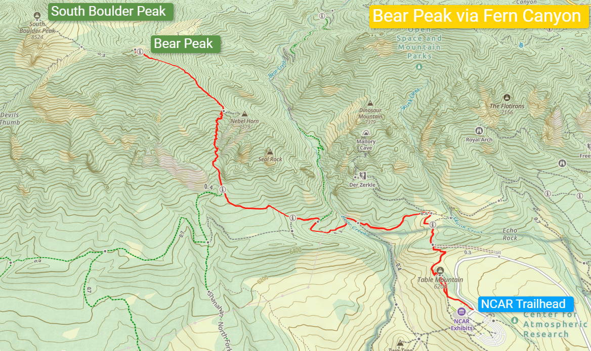
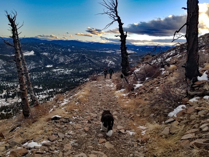
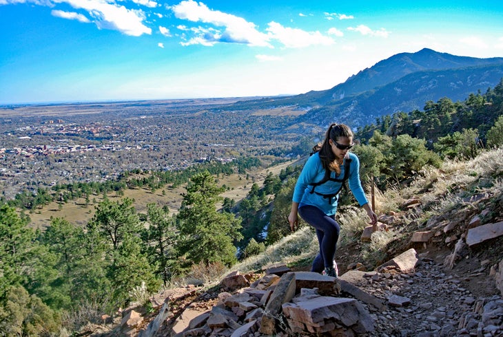
Bear Peak via Fern Canyon
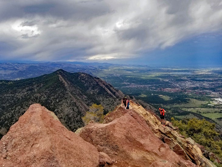
✅ Best Summit Views
► I love everything about this hike. It starts out on the amazing grounds of the National Center for Atmospheric Research (NCAR), where parking is free, plentiful, and paved. Descending into the forests of the foothills is a quiet transformation that is fully realized in the rich flora of Fern Canyon. The last push to the summit is a great workout. The summit block is the “chef’s kiss” ending to an already excellent hike.
Trailhead Parking: 39.97937, -105.27467
Distance: 5.6 miles out-and-back
Elevation Gain: 2,755 feet
Notes: No parking fees. Dogs must be leashed or have Boulder’s Voice and Sight tags in designated areas.
Download: Bear Peak via Fern Canyon GPX file
- Shady, steep access trail
- Best 360-degree summit views in Boulder
- Exciting little summit scramble
This route starts at the parking lot of NCAR, a futuristic-vibe building that overlooks the city of Boulder from its location atop a modest mesa. Begin your hike by passing through a short 0.1-mile collection of informative plaques, then follow the NCAR Trail downhill to its junction with the Mesa Trail. Take the Mesa Trail south as it descends to Bear Creek.
At roughly 1.4 miles into your hike, turn right (west) into the Fern Canyon Trail. This shady, steep trail grinds up rocky terrain, occasionally using stone steps to ascent short, punchy sections. Eventually, the trail hits a series of switchbacks before arriving at a short-lived saddle between Bear Peak and a rock feature known as Nebel Horn. After a brief pause, the trail resumes its vertical prerogative. The last quarter-mile scrambles along rocky plates and finally breaks above treeline, culminating in a surprisingly thrilling short scramble to Bear Peak’s summit. The open 360-degree views from the top may be the very best in all of Boulder. Note the iron-heavy rock of the summit block can get very slick when wet.
Peak baggers almost can’t resist the 20-minute hike from Bear Peak to 8,550’ South Boulder Peak. It’s a 0.3-mile walk one-way (0.6 miles out-and-back from Bear’s summit area) and worth the trek, though the views are better from the slightly lower Bear Peak. Return via Fern Canyon to the Mesa Trail and back to the NCAR Trailhead.
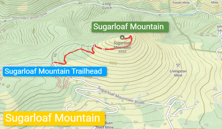
Sugarloaf Mountain
✅ Best Easy Hike With Ridiculously Good Views
► Despite being only about a 20-minute drive from downtown Boulder, Sugarloaf is more of a locals’ mountain than a tourist attraction. It’s a great destination for photographers or those who want to simply sit and take in the thought-provoking difference between the civilized plains to the east and the wild mountains to the west.
Trailhead Parking: 40.02540, -105.42520
Distance: 1.3 miles out-and-back
Elevation Gain: 411 feet
Notes: Parking is free. Sugarloaf Mountain Road is a 1-mile dirt road that turns off the paved Sugarloaf Road at its highest point. It’s steep but passable by passenger cars and is maintained throughout the year.
Download: Sugarloaf GPX file
- High-elevation summit with a low-mileage hike
- Excellent vantage point between the foothills and the Rocky Mountains
- The perfect peak for a mountain picnic
Sugarloaf Mountain is the namesake peak of the Sugarloaf community, a rural pocket of incorporated Boulder County. Despite being a short and relatively easy walk-up, Sugarloaf’s summit is 8,924 feet—taller than the high peaks that stand over Boulder’s Flatiron rock formations.
Sugarloaf sits as a midway point between the plains to the east and the first true surge of the 10,000-foot plus peaks of the Rocky Mountains spanning the western horizon. It’s a quick hike and a perfect escape when you’re short on time or just want stunning views for less effort. Sunrises and sunsets are equally spectacular from atop Sugarloaf Mountain. It’s a good family hike for hearty kids. The rocky summit area has the shells of elder trees that perished in fires. The trail is never severely exposed or steep, but it can take your breath away if you haven’t acclimated to high altitude.
It’s a simple, straightforward mountain, and well worth the visit. It’s interesting to see the trio of 8,000-foot peaks above Boulder from the west. The glowing metropolis of Denver shines to the east, a distant contrast from the rugged, hilly terrain underfoot.
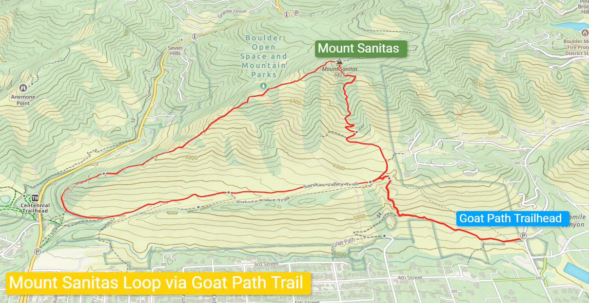
Mount Sanitas Loop via the Goat Path Trail
✅ Best Classic Boulder Hike With City Views
► When I lived in North Boulder, it wasn’t unusual to do this route five days a week and over 100 times a year. It was a great place to hike or run with my border collie, though it didn’t really seem to tire him out much. If you’re going in the winter, bring microspikes, as the trail still sees a lot of traffic, and the snow gets pressed into ice fairly quickly.
Trailhead Parking: 40.04103, -105.29399
Distance: 3.9-mile lollipop loop
Elevation Gain: 1,650 feet
Notes: Parking is free at this particular trailhead off Linden Avenue. Dogs must be leashed or have Boulder’s Voice and Sight tags in designated areas.
Download: Mount Sanitas GPX file
- Great workout right in town
- Spanning eastern views to Denver and beyond
- Good for people watching
Mount Sanitas is one of Boulder’s most popular mountain hikes. It’s right in town and is a heck of a workout—1,650 vertical feet—in a a 1-1.5 hour outing. It can be busy, especially on weekends, but the crowds tend to disperse along the trails. Trail runners and folks walking their dogs are often in the mix with hikers.
This route starts at the northern end of the trail system along the Goat Path Trail, a quieter alternative to the busier, pay parking lots to the south. Parking at the Goat Path Trailhead is free. A prelude walk up the Goat Path ends with a steep but short connection to the Sanitas Valley Trail, then loops up to the 6,835-foot summit. Note that this high point is technically the shoulder of an unnamed parent peak known informally as “Northwest Sanitas”, which is on private property.
Ramble south down the well-maintained rock staircases and occasional flats as you return to the Sanitas Valley Trail to close the loop. Views of Boulder and, eventually, Denver to the east are showcased throughout the hike. Sunsets here can be particularly enchanting. Finish the hike by taking the Goat Path downhill and back to the parking area.
Walker Ranch Loop
✅ Best Winter Hike
► I love mountain biking Walker as much as I do hiking it. Walking the trail lets you see more details than you would zipping by on a bike—and there is a lot to see. The river areas are particularly pretty, with large pines framing the fast-moving water. If you’re short on time, you can always go counterclockwise at the start and get down to the river (1 mile), enjoy the lush canyon, and then trudge right back up.
Trailhead Parking: 39.95129, -105.33737
Distance: 7.7 mile loop
Elevation Gain: 1,914 feet
Notes: Parking is free. Dogs must be on leash. Please be extra careful with your dogs around the swift water of South Boulder Creek; the current moves fast enough to sweep even big breeds away in a flash.
Download: Walker Ranch Loop GPX file
- The midpoint of the loop descends to a gorgeous riverside area
- A great shoulder-season loop
- Scenic drive to the trailhead
Walker Ranch is a good hike year-round, but it’s a multi-use trail that does allow mountain bikes—so keep an eye out for people on two wheelers. (Admittedly, it’s a very fun place to mountain bike thanks to the burly climbs, occasional technical sections, and screaming-fast downhills.) Walker Ranch is thus one of my favorite winter hikes since there will only be a smattering of cold-weather bikers—often none at all. Shoulder season conditions of cold or snow also keep bikers away.
The Walker Ranch Loop Trailhead is the standard starting point. Getting there involves a drive (or pedal, if you’re feeling feisty) up Flagstaff Road, a steep, paved, switchbacking mountain road that grinds up to the trailhead. Once there, the loop can be hiked in either direction—I prefer clockwise, but you can’t go wrong either way.
Going clockwise, you’ll begin your hike with a short descent and quick ascent to the trail’s highest point at 7,311 feet. From there, drop into a shady forest that begins an 800-vertical-foot drop down to 6,477 feet into the mini-canyon of South Boulder Creek. Cross a sturdy bridge over the creek and scramble to the base of a long staircase. This is a great place for lunch. Push up the stairs and continue the loop, ascending to the Crescent Meadows Trailhead, then dropping back to South Boulder Creek. The final mile out climbs an open hillside and gains 600 vertical feet. I prefer ascending the mid-way staircase versus descending it, so I like sticking to the clockwise route.

Doudy Draw to Flatirons Vista
✅ Best Hike for Wildflowers and Flora
► As much as I love mountain hikes, the plains of south Boulder are also strikingly beautiful. This is one of my favorite hikes for dogs, especially in the colder months. Easing along the flat land below the mesa to the higher, the forested area feels surprisingly dramatic. Views of the Flatirons and into Eldorado Canyon are mesmerizing. This trail system is also excellent for runners.
Trailhead Parking: 39.93808, -105.25655
Distance: 7.5-mile lollipop loop
Elevation Gain: 895 feet
Notes: $5 daily / $25 annual fee for non-Boulder residents. Dogs must be leashed or have Boulder’s Voice and Sight tags. Don’t park on the road if they’re aren’t spots are available in the Doudy Draw Lot. Instead, try the South Mesa Trailhead just across the street. Boulder cops love to give tickets to cars parked on the road.
Download: Doudy Draw-Flatirons Vista GPX file
- The hike starts with open meadows and then reaches a scenic pine forest
- Unique views of South Boulder’s preserved grasslands
- Options to link into several other trails
Boulder’s wildflower season usually peaks in early June, and no local hike blooms with as much beauty as the Flatirons Vista Trail. This hike begins at the Doudy Draw Trailhead and can get very busy on summer weekends. It’s best to go late in the day or early on weekends.
The trail itself begins on a flat, gravel path that morphs into the Doudy Draw Trail. Open meadows highlight the last vestige of the Great Plains before rising into the foothills. Continue up a switchbacking trail where the views open momentarily before ducking back into the sparsely forested Flatirons Vista Trail. This loop is a 3-mile tour of the mesa that reaches all the way to Highway 93 before turning west back down to Doudy Draw. The flora-rich forest gives way to open plains with expansive views in all directions. Return back down to Doudy Draw to close the lollipop loop.
There are a lot of options to explore this area of South Boulder. Going west explores the Springbrook Trail. Farther east, it takes you to the Greenbelt Plateau and the Marshall Mesa area mentioned above (this is a good point-to-point if you have two vehicles).

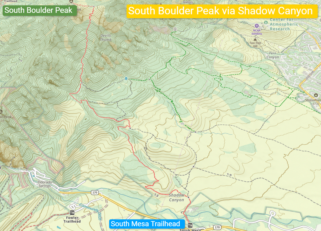
South Boulder Peak via Shadow Canyon
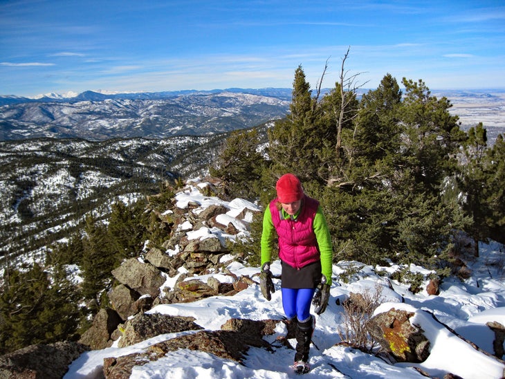
✅ Best Hike to Reach the Highest Point in the Flatirons
► The Shadow Canyon route begins on the plains and ends on a mountaintop. It’s incredible to pass through so many ecosystems along the way. Shadow Canyon isn’t just a good, sturdy hike. It’s also a great place to spot one of Boulder’s local black bears. The South Boulder – Bear combo from Shadow Canyon is an unbeatable duo that is premier Boulder hiking.
Trailhead Parking: 39.93872, -105.25827
Distance: 8 miles out-and-back
Elevation Gain: 3,160 feet
Notes: $5 daily / $25 annual fee for non-Boulder residents. Dogs must be leashed or have Boulder’s Voice and Sight tags. Like Doudy Draw, do not park on the road if no spots are available. Summer weekends can be hard to get a parking spot, so get going early (7 A.M. or earlier). This will also help you beat afternoon thunderstorms.
Download: South Boulder Peak via Shadow Canyon GPX file
- Scrappy hike, mostly in shade, to the summit
- Reasonable to link up with Bear Peak
- Hike through a burn zone
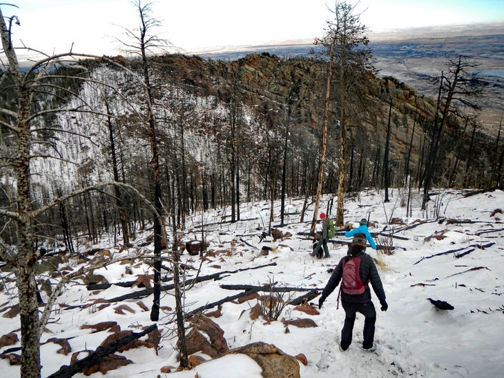
There are legit mountain hikes in Boulder city proper, and South Boulder Peak (8,550 feet) is the highest of them all (though it’s not the highest point in Boulder County; that belongs to 14,259-foot Longs Peak). Even though it wears the elevation crown, the summit is only partially exposed as there are forested patches to the east and north of the highest point. Still, the views are great, but the hike up Shadow Canyon makes this route a classic.
The trail starts at the South Mesa Trailhead and passes an old homestead on the Mesa Trail before merging with the appropriately named Homestead Trail. The transition from the plains into the foothills is enchanting. You’re seeing the start of the Rocky Mountains themselves. The Homestead Trail ends at the Shadow Canyon Trail at 2.2 miles, where the real work begins. Push up through the also aptly named Shadow Canyon to a high saddle between South Boulder Peak and Bear Peak. En route to the top, you’ll pass through an eerie burn zone, the result of a lightning strike fire in June 2012.
The final trail to the top involves easy rock scrambling. Peak baggers can return to the saddle and make the short trek north 0.2 miles to Bear Peak, tag it, then return back to the saddle and down the Shadow Canyon.
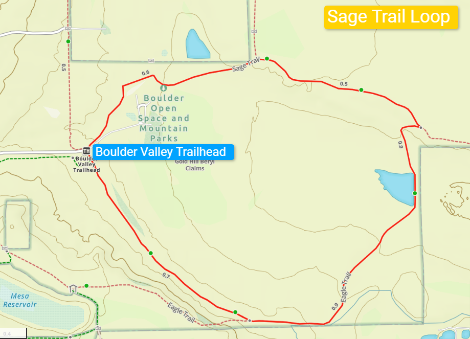
Sage Trail
✅ Best Quiet Hike in North Boulder
► Even though it’s easy to access, the Sage Trail is often less crowded than the trails in South and Central Boulder. The network of trails is a wanderer’s dream. You can connect all the way to Left Hand Valley Reservoir, Boulder Reservoir, or even Mount Sanitas and beyond if you don’t mind crossing a few streets. As a simple hike, the Sage Trail is a peaceful, quiet retreat that truly feels like you’ve been transported to a much more remote place.
Trailhead Parking: 40.07991, -105.26273
Distance: 2.8-mile loop
Elevation Gain: 254 feet
Notes: There are no fees to park at the Boulder Valley Ranch Trailhead. Dogs must be leashed or have Boulder’s Voice and Sight tags.
Download: Sage Trail GPX file
- Wander through open farmland that feels far outside of the city
- Great for dogs and social hikes
- Good network of trails to easily add more miles
Much like Sawhill Ponds, the Sage Trail showcases the softer side of Boulder. This loop skirts Boulder Valley Ranch, a working ranch that is tucked below a mesa in north Boulder. As a result, the city disappears from view, and you are treated to open prairie views that belie the bustling city to the south.
By Boulder standards, this is a relatively flat trail, though it still gains 254 vertical feet thanks to a ramp on the east side of the trail. A small pond glistens in the sun on the east side of the trail. My preferred direction of travel is counterclockwise, following an irrigation ditch. Plenty of detours are available in the north Boulder network of trails, including a half-mile trek up to Mesa Reservoir to the west.
But if you stay on the main Sage Trail, you’ll have an easy and enjoyable 45-minute to 1-hour walk that tours the part of Boulder that begins to ease back into the open prairie. A quick glance at Gaia GPS or other mapping apps shows the layout of connected trails that go all the way from Wonderland Lake in town to Boulder Reservoir to the east.
Best Big All-Day Hikes in Boulder
Want to go for the gold? These combination hikes crank up the mileage and vert to give you a full day’s worth of adventure.
| Hike | Biggest Challenge | Distance | Best For |
| Guardians of the Flatirons | Tons of vertical | 14.4 miles | Triple summit day |
| Boulder Creek Path to Chapman Drive + Beyond | Deciding how far you want to go | 11 miles | Great option from downtown Boulder |
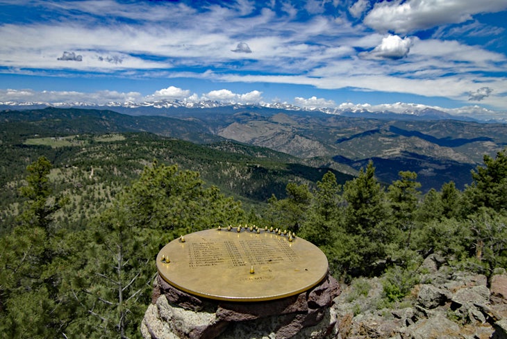
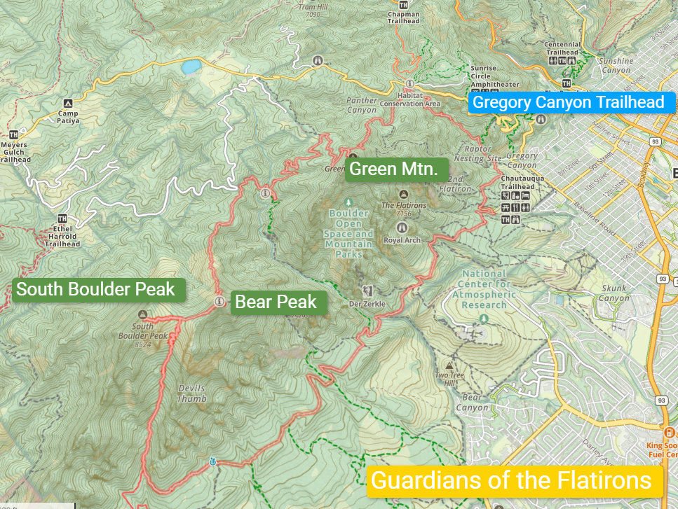
Guardians of the Flatirons: Green Mountain – Bear Peak – South Boulder Peak
Trailhead Parking: 39.99745, -105.29273
Distance: 14.4-mile loop
Elevation Gain: 5,165 feet
Notes: $5 daily / $25 annual fee for non-Boulder residents. Dogs must be leashed or have Boulder’s Voice and Sight tags.
Download: Guardians of the Flatirons GPX file
This mega-mountain hike is an all-day affair. It tours the three summit peaks above the Flatiron rock formations, connecting them via a series of trails exploring the peaks’ less-seen western side. The route begins with the Green Mountain hike via Gregory Canyon. From there, follow the Green Canyon Northwest Ridge Trail to the Green Bear Trail (my favorite named trail in Boulder). Green Bear connects with the incredible Bear Peak West Ridge Trail, one of the most spectacular hiking routes in the Front Range. This trail leads into a burn zone, then up a series of switchbacks to Bear Peak’s exposed summit.
From there, hike over to South Boulder Peak via the South Boulder Peak Trail, then descend the Shadow Canyon Trail to the Mesa Trail, where a 5.4-mile walk of the Mesa Trail goes north below the Flatirons and back to the Gregory Canyon Trailhead.
Guardians of the Flatirons is a segment of the locally popular “Skyline Traverse.” The name is a bit of a misnomer because that particular route starts at Mount Sanitas, then drops back into town before ascending Flagstaff Mountain, then over to the Guardians trio. It spends a lot of time not along the skyline.
The Guardians of the Flatirons is actually more of a skyline traverse than the Skyline Traverse. The route stays as high as possible, never going below 7,000 feet from the time you top out on Green Mountain until you finish your summits and drop into Shadow Canyon.
It’s a big ol’ fun day and should not be underestimated. There is a bail-out point where the Bear Peak West Ridge Trail meets the Bear Canyon Trail. You can gain the Mesa Trail via Bear Canyon back to Gregory Canyon or exit to NCAR parking, a possible point-to-point warm-up if you want to sample the route before going all in.
Boulder Creek Path to Chapman Drive + Beyond
Start: Anywhere in downtown Boulder on the Boulder Creek Path (parking at Eben G. Fine used in this route: 40.01338, -105.29445)
Distance: 11 miles and beyond
Elevation Gain: 2,112 feet
Notes: Dogs must be leashed or have Boulder’s Voice and Sight tags.
Download: Boulder Creek Path to Chapman Drive GPX file
This route is a bit of a different tour, as it starts on the paved Boulder Creek Path and cruises 3 miles up Boulder Canyon to Chapman Drive, a dirt road that was transformed into a hiking and biking trail. If you stay downtown, you can jump on the path anywhere it passes and head west. This route begins at the Eben G. Fine Park/Settler’s Park parking lot.
The Boulder Creek Path parallels the eponymous creek as it climbs into the canyon. The trail starts close to the road but then crosses under a bridge and isolates itself a bit from traffic. The rock climbing that makes Boulder Canyon famous can be seen along the way, with dramatic cliffs rising from the canyon floor. There’s a lot of decent people watching, too.
At about 3 miles up, the Boulder Creek Path terminates at the Chapman Drive Trailhead. This converted road climbs all the way to Realization Point on Flagstaff Road and can be used to access Green Mountain via the Green Mountain Lodge Road and the Ranger Trail. If you hoof it to Realization Point and back, you’ll have an 11-mile day that ends in downtown Boulder.

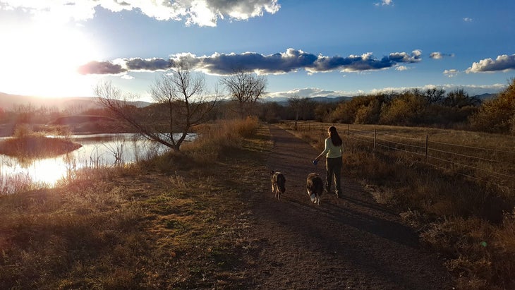
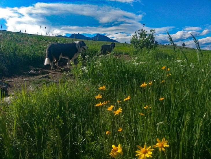
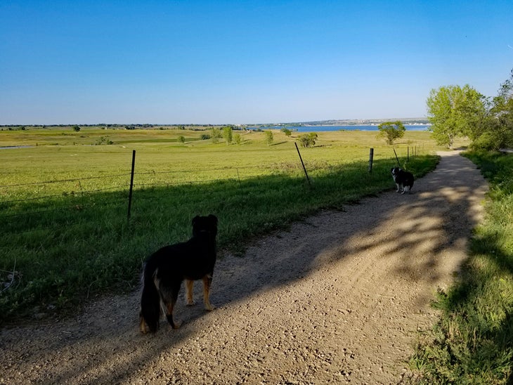
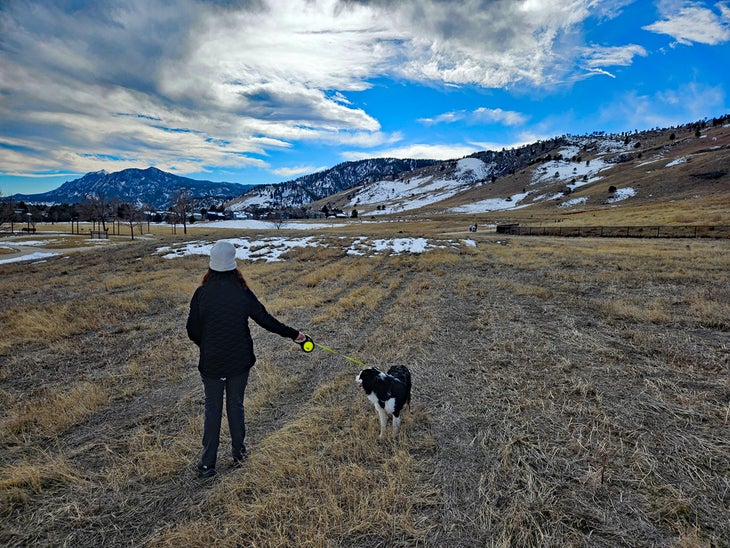
Best Dog Park – Hike Combos
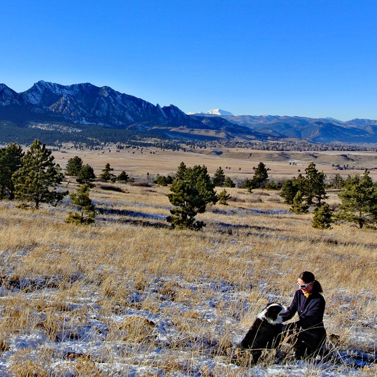
As a bonus, I added these three dog park-hike combinations because Boulder is an excellent place to explore with your canine pals. I have loved sharing these places with my dogs, and I bet your pups will be equally as excited to check them out.
For off-leash fun, you’ll need Boulder’s Voice and Sight tags for the hiking portion of these outings. The fenced-in dog parks at Foothills Community Park and Davidson Mesa do not require tags for off-leash action. Dry Creek does require Voice and Sight tags at all times.
| Hike | Difficulty | Distance | Best For |
| Foothills Park | Easy | 2.4 miles | Easy walks to Wonderland Lake |
| Dry Creek | Easy | 1.8 miles | De facto dog park with open space and water |
| Davidson Mesa | Easy | 3.2 miles | Stunning western views of the Indian Peaks |
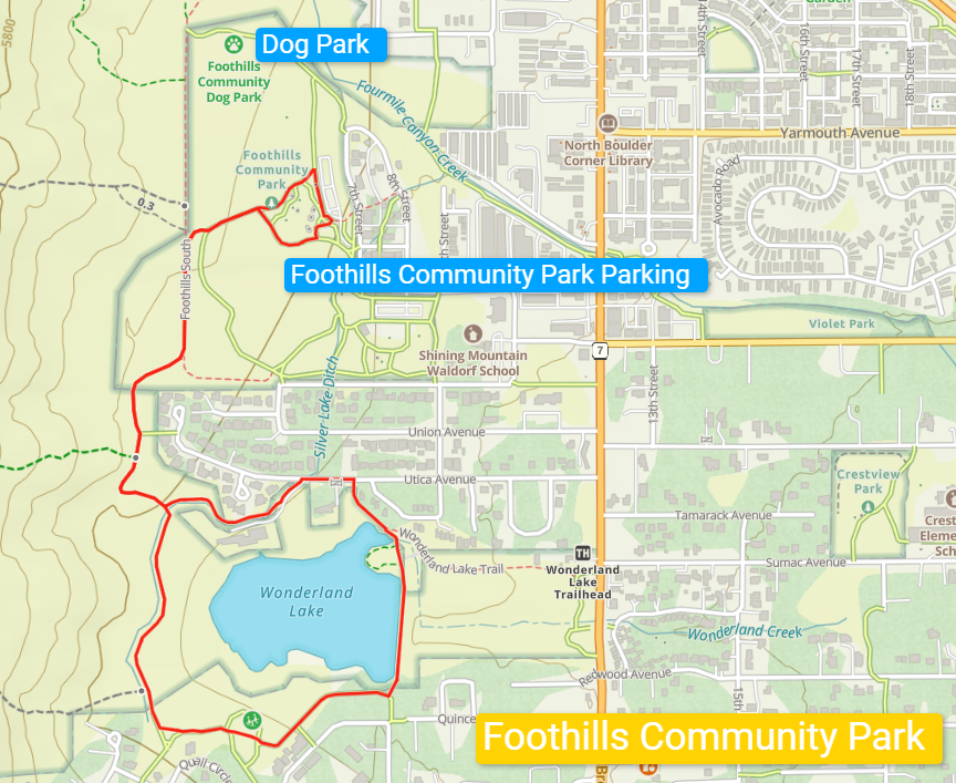
Foothills Community Park
Parking: Foothills Community Park, North Boulder; 40.05717, -105.28828
All three of these hikes feature a fully fenced-in dog park where your pup can socialize as well as hiking trails for some one-on-one time with your doggo.
Foothills Community Park is a beautiful, spacious area in North Boulder where you can walk over to Wonderland Lake or simply wander the base of the foothills. If you have a fit pup (and it’s not too hot out), you can head all the way to the Sage Trail via the Foothills North Trail, a path that connects to the park and goes under Highway 36.
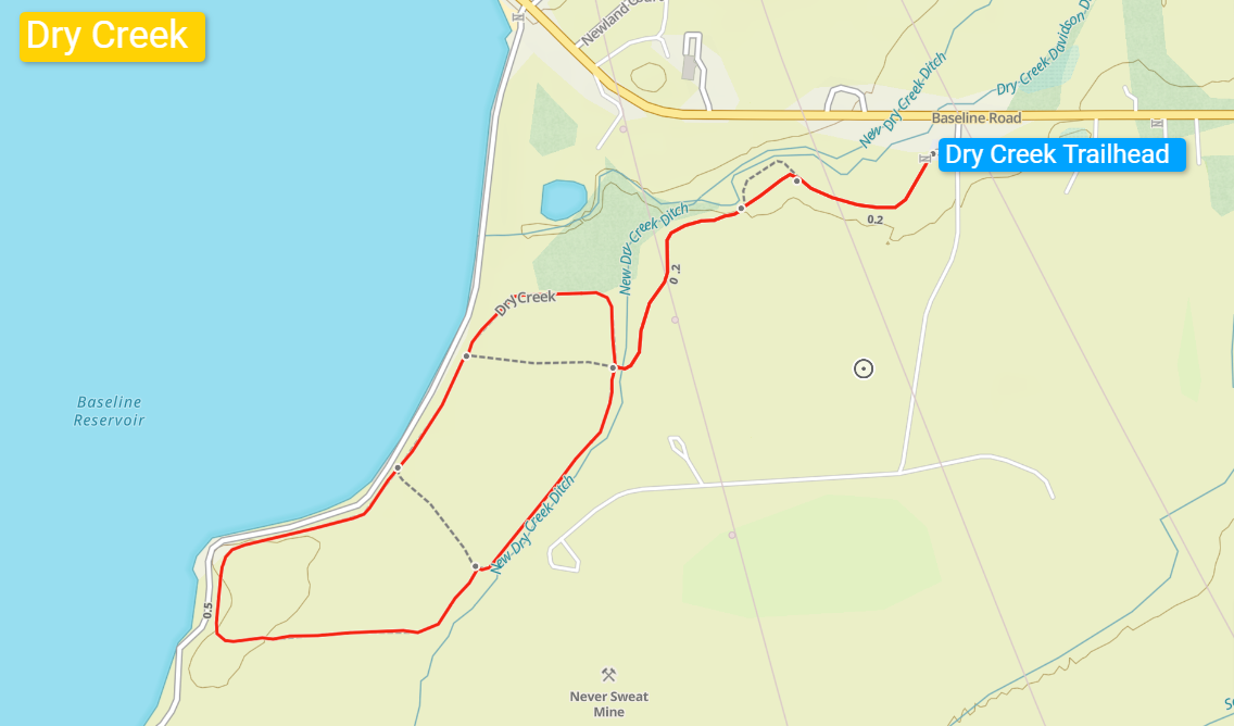
Dry Creek
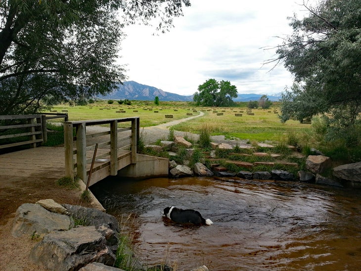
Parking: Dry Creek Trailhead; 39.99963, -105.19086
While Dry Creek is not technically a dog park, it is a fully-fenced Open Space area that is a defacto local dog park. There is a small creek for pups to splash around before opening up to a large, flat field offering a nice 1-mile loop.
The park has become more popular recently—weekends can get hectic. But the views of Baseline Reservoir and the Flatirons are quite fetching, and it’s a great place to let your dogs get their zoomies out. You’ll need Voice and Sight Tags if your dog is to be off-leash here. Be sure to visit the majestic cottonwood tree on the park’s western side, where many very good boys and girls have left their pawprints.
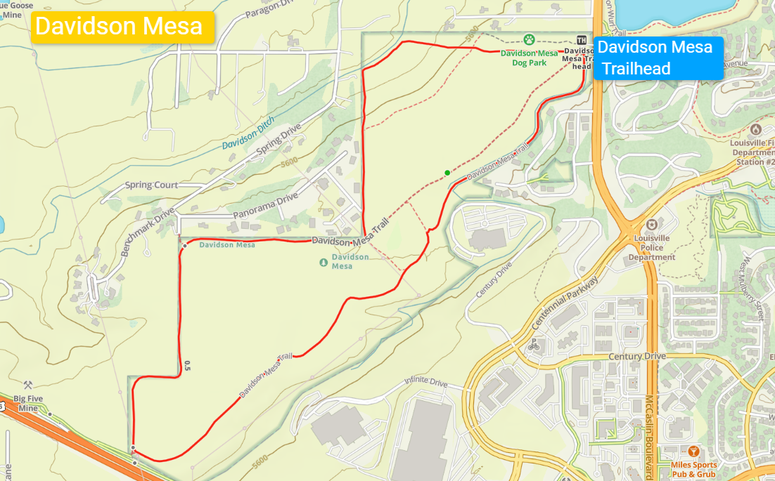
Davidson Mesa
Parking: Davidson Mesa Trailhead, Louisville, CO; 39.97827, -105.16645. There is an overflow parking lot on Washington Avenue, across the street from the Davidson Mesa Trailhead. A tunnel runs under the road to safely walk to the dog park and trails.
Dogs must be on leash when not in the dog park, regardless of their Voice and Sight tags.
Technically, this one is in neighboring Louisville, but it’s still in Boulder County, so I’m going to count it. It’s nearly on the eastern border with Boulder (less than 2 miles away), but more importantly, it may very well be the most spectacular dog park in the country.
Davidson Mesa has awesome views of the Flatirons and the Indian Peaks beyond. I don’t use “awesome” lightly here; it’s an astounding piece of real estate with a fully fenced-in dog park. Sunsets from Davidson Mesa are postcard-worthy nearly every night.
Beyond the park, some nice, flat trails dink around on the mesa itself. A semi-hidden trail drops down to Davidson Ditch, a secret dunking spot for pups on warm days. The ditch does tend to run dry by the end of summer, though. The views are incredible wherever you roam, and it’s a great place to socialize your pup. As a bonus, most of the hiking trails are as wide as dirt roads, giving you plenty of room to separate dogs that might be less social.
Gear for Hiking in Boulder
For the more casual, flat hikes listed here, you may want nothing more than a water bottle and sunscreen. But mountain hikes are honest-to-goodness adventures that require an appropriate gear setup. This includes:
- At least two liters of water
- Light hiking shoes in spring/summer/autumn and full hiking boots in winter
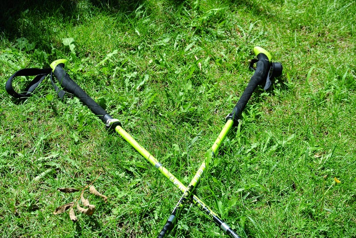
- Hiking poles
- First-aid kit
- Snacks
- Layers
- Light jacket or fleece for three-season hiking
- Puffer and shell in winter
- Visor or sunhat in summer
- Sunscreen
- Sunglasses
- Maps/mapping apps
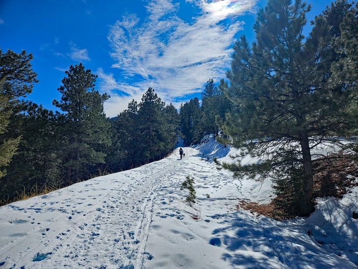
- Microspikes are a must in winter or in snowy conditions
Summer can get very hot in Boulder, even at high elevations. It’s not unusual to have days over 100 degrees Fahrenheit. Generally, I tend to avoid hiking during the hottest part of the day (usually 1-4 P.M.). Bring extra hydration on days over 80 degrees.
Conversely, winter days can be bitterly cold, dropping well below zero. Even though Boulder has well-marked trails, every year, hikers get lost on snowy days when trails are obscured or get caught out after dark. Boulder’s mountain hikes are a blast in cold months, but please treat them with the respect they deserve.
Cell Reception in Boulder Mountain Areas
Boulder’s ridgelines and mountain tops have cell reception, but the canyons and gullies that lead up to them often do not. It’s a good idea to download maps for offline use before you head up, even if you’ll likely get back in data range wherever you hike.
Weather Tips and Other Advice for Hiking in Boulder
- Check the forecast before heading out. Some summers, thunderstorms hit almost daily, usually starting about 3 P.M.
- Boulder’s climate is generally temperate, though summer days can get extremely hot. It’s also not unusual to have bright sunny days in the 40s and 50s, even mid-January. Be aware that Boulder does get cold snaps where the temps stay pinned well below zero.
- Because Boulder has a dry climate, I don’t wear Gore-Tex lined shoes and generally prefer well-ventilated, light hikers. Since this is Boulder, you’ll see hikers in sandals and even the occasional barefoot walker (not advised unless you’re a fan of tetanus shots).
- Hiking poles are my secret weapon when it comes to healthy knees. Many Boulder mountain trails are steep, and descents are particularly good for poles.
A Note on Boulder Wildlife
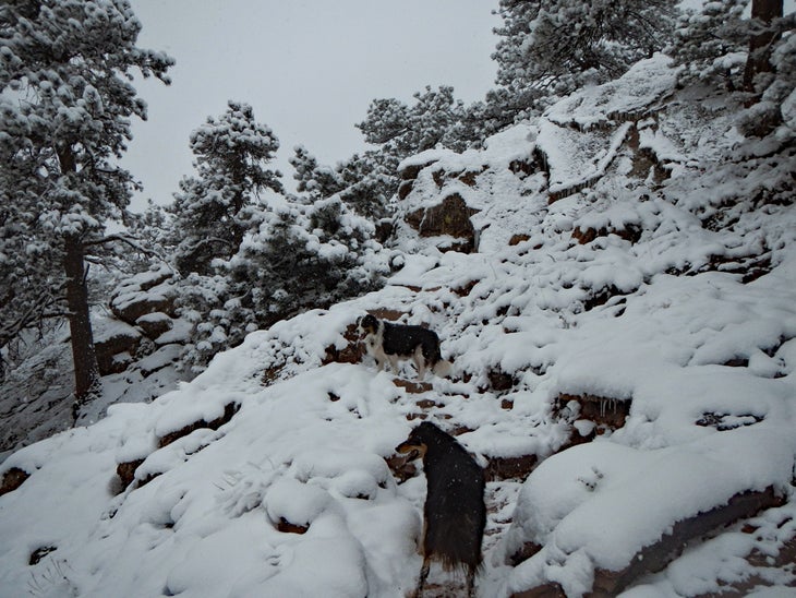
Black bear sightings are common in Boulder; attacks on hikers are not. Black bears are generally shy or perhaps curious but rarely aggressive. Give them space if you see them, and if they happen to be plopped down on the trail, you may have to turn around. Bears with cubs should be treated cautiously, as moms can be protective.
Boulder does have resident mountain lions. As with black bears, encounters are rare, but unlike black bears, if a mountain lion does appear aggressive, make yourself look big. Shout, do not turn your back on them, stay calm (good luck with that), and slowly back off.
As a local with over 25 years of hiking in Boulder, moose are the only creatures I worry about encountering. Moose have become much more common in Boulder, starting around 2012. They are big, strong, and somewhat intellectually dull—it comes with the territory of being huge and having few predators in Colorado. They rarely have to outwit other critters. If I see moose, I do all I can to walk away quietly. I’ve missed out on hikes because a moose was on the trail, but it was the right call in every case.
Dog Regulations for Hiking in Boulder
Boulder has a Voice and Sight tag program for dogs. This program allows well-behaved dogs to roam on designated trails off-leash. If you don’t have a Voice and Sight tag, your dog can only be off-leash in designated, fenced-in dog parks and be on leash everywhere else.
That said, there are a lot of dogs in Boulder, and conflicts arise from time to time. Be aware of your dog’s personality and keep them leashed if you are uncertain of their behavior, even if you have Voice and Sight tags. And please pick up after your pups—if people didn’t pick up their dogs’ poo, there would be enough to fill Folsom Field in no time.
Final Thoughts
While there are many, many more trails in Boulder, this collection highlights the best of the best. For the adventurous, here’s a clue to finding the best locals’ secrets: many of the top trails not mentioned in this mini-guide are connected to the routes listed here, so… keep your eyes open and study those maps.
I’ve been fortunate to spend over two decades roaming in Boulder. From the plains to the mountains, the wilderness in my hometown never ceases to amaze me. Despite being part of a civilized city, parts of Boulder are still wild. There are many places, such as the Bear Peak West Ridge Trail and Sawhill Ponds, where the city itself seems half a world away. I love that.
I hope your hiking adventures in Boulder are just as fun and memorable as mine have been. Whether you are visiting or call Boulder home, the city’s commitment to world-class trails makes this place among the best hike-friendly places in the country.
Additional Resources
- City of Boulder Open Space & Mountain Parks Website
- Boulder County Parks & Open Space Website
- Boulder Open Space and Mountain Parks Interactive Trail Maps
About the Author
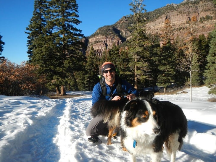
I am the author of six mountain hiking guidebooks for Colorado and work as the SEO Director at Outside. If there is something better in the world than exploring the mountains with great friends and fine dogs, I haven’t found it. I’ve lived in Boulder for 25 years, where I hike on local trails on a daily basis—I even build my own trails.