The hike was hot and brutal. My wife and I started on the edge of Sabana de la Mar, a village in the Dominican Republic, after breakfast and drove our rental car until the road ended. Then we navigated patchwork farms until dipping into the jungle and heading toward the coast. Liz and I were young and unprepared, so we ran out of food and water almost immediately, eating mangoes from trees and trying to crack coconuts in our thirst.
Our goal was an isolated beach with a two-stool, open-air bar that you could only reach by boat or hike. We were tired of crowded resorts and wanted something serene. We didn’t find a boat so we hiked. And hiked. And hiked. The bar was closed when we got there, but we had the beach to ourselves: a quarter-moon sliver of sand flanked by tall palms, the Samana Bay stretched out before us.
Sometimes I want to stand on a beach or outcropping or mountaintop and know that the nearest McDonald’s is days away. But just because a destination is far-flung doesn’t mean you actually want to go there.
For example, the farthest-away spot in the United States is Saint Matthew Island, which is technically part of Alaska, but located in the Bering Sea more than 180 miles from the nearest human settlement, halfway to Siberia. You have to take a 24-hour ship ride to reach the island, which is battered by storms and shrouded in fog. Oh, and it’s cold. I’m sure Saint Matthew has its charms, but I can think of more pleasant remote places to vacation.
So, I started looking into destinations across the globe that occupy that sweet spot of “remote” and “attractive.” There’s a variety of landscapes on this list, from dunes to hot springs, so it’s not just tropical atolls, although they’re in here, too.
Here are 11 far-flung places worth the endeavor to see them. These spots are just the beginning. It’s a great big world out there. While this is bucket-list stuff, damn, it’s fun to dream.
1. Remote Tropical Island
Lord Howe Island, Australia
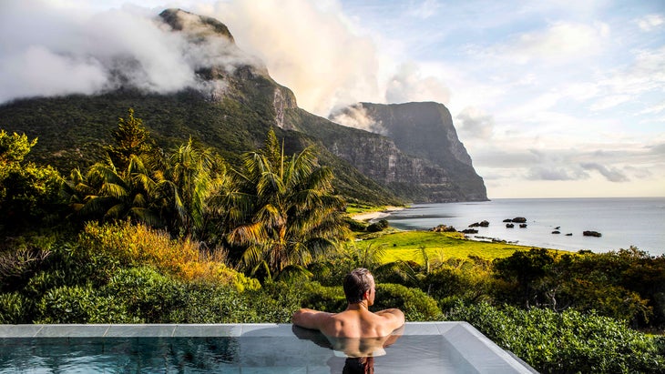
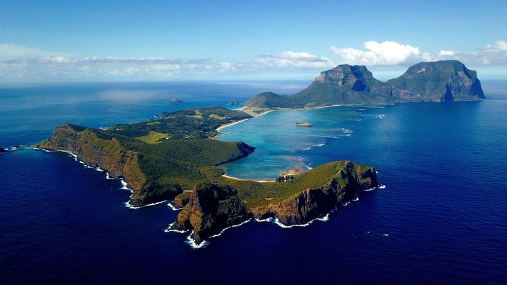
Traveling to a remote island doesn’t always mean you have to enter survival mode. Lord Howe Island is a volcanic remnant in the Tasman Sea, roughly 320 miles east of New South Wales, Australia. It’s remote, sure, but it also has some pretty plush digs, and a small population (roughly 350 people) living on the northern tip of the island opens apartments and small lodges to travelers.
The south end of the island is comprised of primeval forest, isolated beaches, volcanic crags, and towering peaks. The island is only seven miles long and 1.25 miles wide, but roughly 70 percent of that mass is protected as a Permanent Park Preserve. Moreover, locals limit the number of tourists, not allowing more than 400 on the island on any given day.
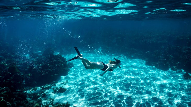
While you’re on-island, spend your time snorkeling in the crystal-clear waters of Ned’s Beach, where sand leads to a coral reef teeming with mullet and kingfish. Arrange with your lodge host for a guide to take you on the three-mile trek to the top of Mount Gower. It’s an all-day adventure that has you scrambling up volcanic rock and hiking through the lush interior forest. The summit rises 2,870 feet above sea level, punctuating the south end of the island.
Or, book a diving excursion to Ball’s Pyramid, the largest sea stack in the world, rising 1,807 feet from the ocean roughly 14 miles south of Lord Howe. There, you’ll see turtles, wahoo, and the rare Ballina Angelfish. Trips and rates are determined once you’re on island, but you can book single-dive excursions to other sites for $160 per person.
How to Get There: A limited number of commercial flights reach Lord Howe from Sydney. It’s a two-hour flight. Accommodations are scarce on the island (there are only 400 beds in total), so book your lodging at the same time as your flight. Beachcomber Lodge has relatively affordable rates (from $300 a night). If you’re looking to splurge, stay at the Capella Lodge, which has nine suites with views of both the Pacific Ocean and Mount Gower (starting at $1,900).
2. Remote Hike
Hornstrandir Nature Reserve, Iceland
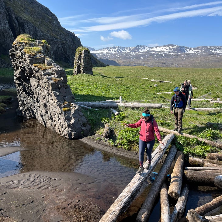
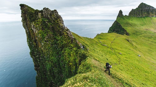
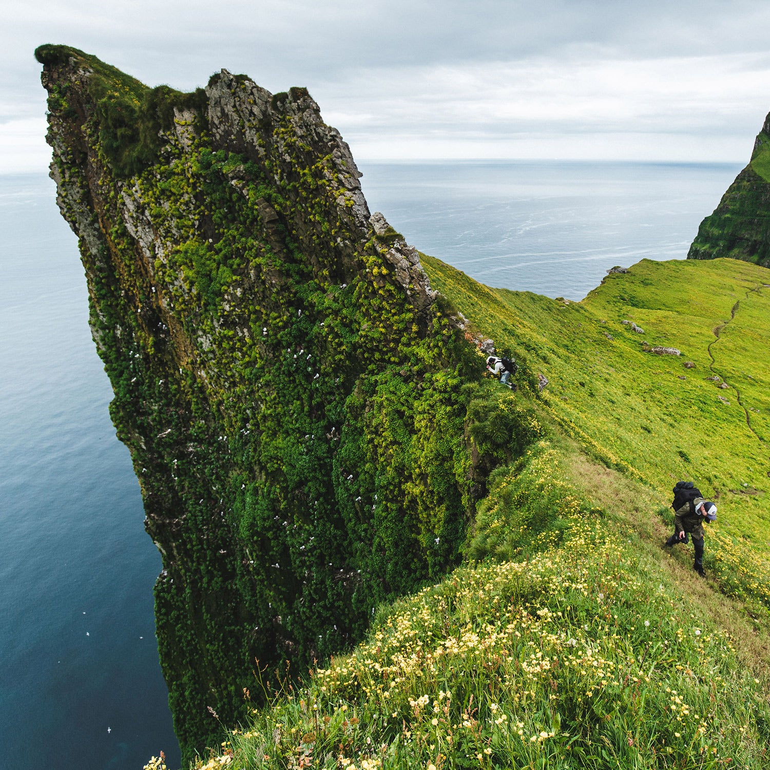
The Hornstrandir Nature Reserve is one of the most isolated areas in Iceland, enveloping a 220-square-mile chunk of the Westfjords, a peninsula on the northern tip of the country where towering cliffs meet deep fjords. Uninhabited since the 1950s, the reserve is blossoming from an environmental perspective; since the last residents left, and with a hunting ban now in place, local species like the Arctic Fox thrive, while seals flock to the rocks against the water.
The beaches are a mix of sand and smooth stones, while ferns and wildflowers dominate the slopes up to the cliffs, with icefields above and waterfalls that drop straight into the sea. Hornbjarg, a massive buttress that rises 534 meters from the Arctic Ocean, looking like a cresting wave, is the biggest draw for hikers. The 10-mile Hornbjarg Loop starts on the gray-sand beach on Hornvik Bay where most people are dropped off (see below) and climbs 3,500 feet up the side of the cliffs.
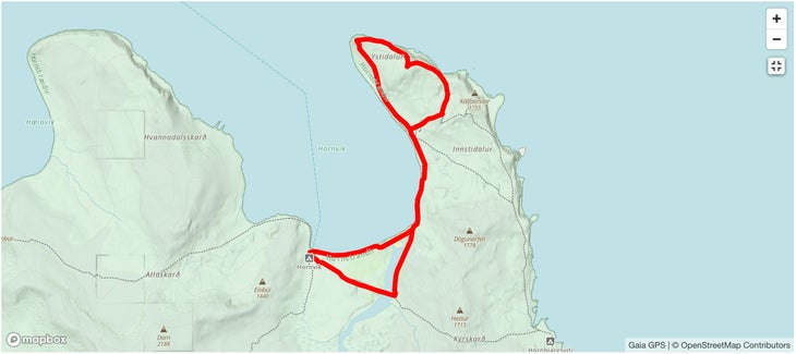
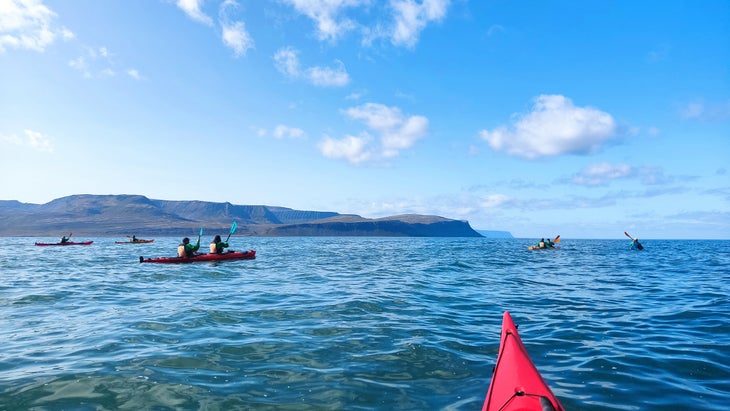
How to Get There: It’s a four-hour drive from Reykjavik to Isafjordur, the capital of the Westfjords, from which you charter a boat across the Bay of Hornvik, or arrange for a guide service to take you across. Arriving at the reserve, you’re on foot, as there are no roads or infrastructure. Borea Adventures offers daily boat rides across the bay, guided hiking trips, and multi-day camping excursions into Hornstrandir (from $375 per person).
3. Remote Ruins
Rio Bec, Mexico
The Calakmul Biosphere Reserve, in the state of Campeche at the base of the Yucatan, Mexico, is known for its Maya archaeological sites. Here, the great ancient city of Calakmul has more than 6,000 documented structures, some towering over the surrounding jungle. You can take organized tours of these and other ruins along with thousands of other tourists every year.
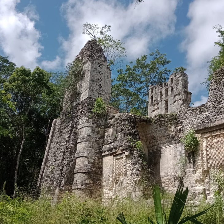
Rio Bec, however, is a lesser-known Maya city tucked more deeply into the jungle of the same reserve that gets a fraction of the visitors. The ruins are so remote, and the jungle so dense, that an entire section of the structures was lost for more than 60 years after the original site discovery in 1912. Put in the extra effort (see below) to come here and you’ll likely have the site to yourself as you climb the steps of stone pyramids stretching 50 feet high, built around 700 A.D.
Some of the buildings have crumbled, while others still boast the skyward-reaching twin towers indicative of the Rio Bec architectural style, unusual in that it serves no practical purpose other than to make a building look more grand. Faux steps going nowhere are even carved into the tower walls. The jungle surrounding the stone structures is full of howler monkeys, jaguars, and wild pigs, and reaching the site is half the adventure.
How to Get There: Fly into the city of Campeche (there’s an international airport) and drive 300 kilometers to Xpujil, the largest town near the Biosphere Reserve. That’s the easy part. No roads lead to Rio Bec, and most tour operators eschew expeditions to the site, as it requires an approach of 15 kilometers (about ten miles) on narrow, difficult trails. Your best option is meeting up with the local guide Humberto Dzib Tun, who takes small groups into the jungle on ATVs and motorcycles ($450 for two people, in cash).
4. Remote Hot Springs
Uunartoq Hot Springs, Greenland
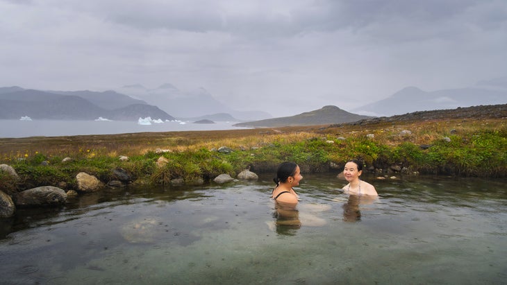
The Inuit word “Uunartoq” translates to “the hot place,” appropriate for this natural spring on an uninhabited island in the middle of a fjord in southern Greenland. While the island has never been permanently settled, legend says that Vikings visited this steaming pool more than 1,000 years ago.
Aside from the addition of a small wooden structure built as a changing room, the springs are the same primitive, rock-dammed pool they have been for centuries. Unlike most hot springs in Greenland (most of which are actually too hot to soak in), the water of Uunartoq is heated not by volcanic activity but by friction, as layers of the earth’s crust rub against each other, warming the water and sending it up to the surface.
The springs are usually between 98 and 100 degrees Fahrenheit, or about the temperature of a welcoming hot tub. Soak in the pool and savor the views of the iceberg-choked bay and the rocky peaks that define southern Greenland. There is no lodging on the island, but you’re welcome to camp. Keep an eye out for the resplendent northern lights.
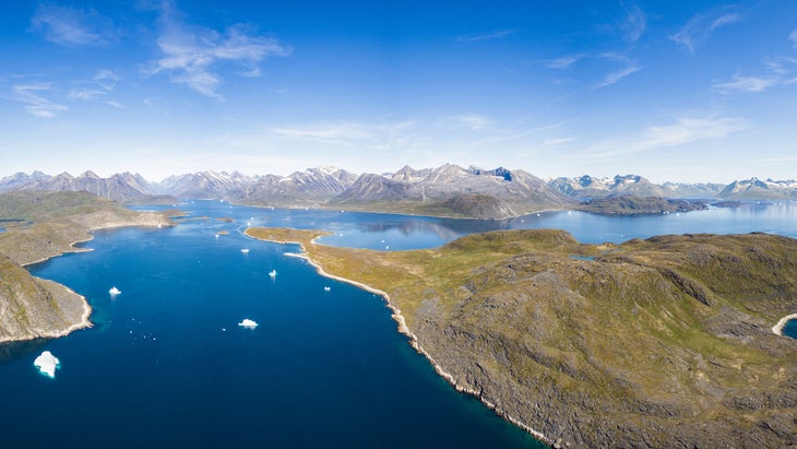
How to Get There: Fly into the international airport at Narsarsuaq, then catch either a flight or boat to the town of Qaqortoq, the gateway to Uunartoq. A number of operators in town offer boats and tours to the springs. It’s a 1.5-hour ride across the Qaqortoq Fjord, which is full of icebergs and where you may see the occasional humpback whale. Sagalands offers a half-day trip from June to September ($375 per person). The company also guides trips to the nearby Greenland Ice Cap and multi-day hikes through South Greenland that have you spending nights on local sheep farms (starting at $140 per person).
5. Remote Lookout Tower
Three Fingers Lookout, Washington
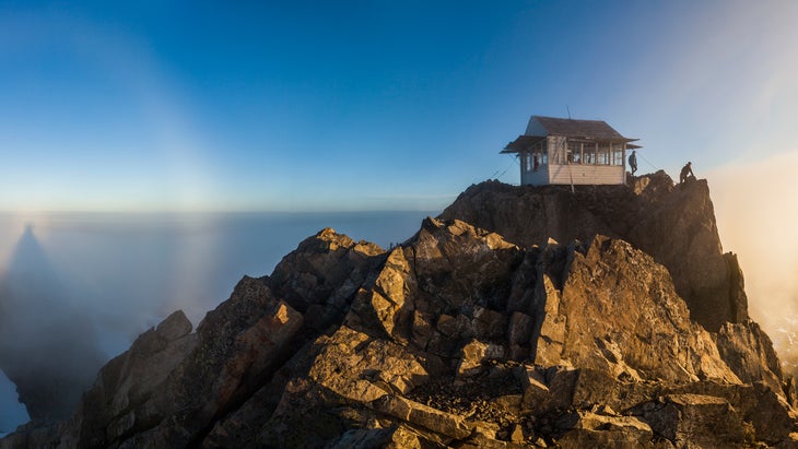
Lookout towers are by definition remote, but Three Fingers takes the concept up a notch, sitting on the summit of Three Fingers Mountain in the heart of Boulder River Wilderness. It requires technical climbing to approach, so you need the equipment and know-how. Built in 1933 using dynamite to blast off a section of the rocky peak, the structure is so significant that it’s on the National Register of Historic Places.
The journey to the tower is awesome but to be taken seriously. Hike for six miles through a dense forest and amid subalpine meadows to Tin Pan Gap, where the technical climbing begins. You’ll need ice axes, crampons, rope, harnesses, and route-finding capabilities to negotiate snowfields and a glacier, scramble up rocky pitches, and finally climb a series of vertical ladders to the lookout on the south peak of Three Fingers Mountain.
The lookout tower sits at 6,854 feet and sleeps three or four people—first come, first served. The views extend deep into Boulder River wilderness, and you’ll be able to spot the 6,865-foot Whitehorse Mountain to the north and 5,437-foot Liberty Mountain to the south. Goat Flat, five miles from the trailhead, is a ridge-top meadow that makes an excellent campsite if you can’t score a night in the lookout.
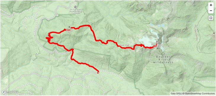
How to Get There: Granite Falls, Washington, is the closest town. The shortest route to the tower is from the trailhead for Trail 641, the Three Fingers-Goat-Flats-Saddle Lake Trail, at the end of Tupso Pass Road (FS41). It’s a 15-mile out-and-back trek into Boulder River Wilderness, with almost 4,200 feet of elevation gain. If you want a longer trip, check the Washington Trail Association website for the status of Tupso Pass Road, which was washed out at the time of publication and would add eight miles of gravel road walking. You can also take this 24-mile out-and-back alternative.
6. Remote Whitewater
Middle Fork of the Salmon River, Idaho
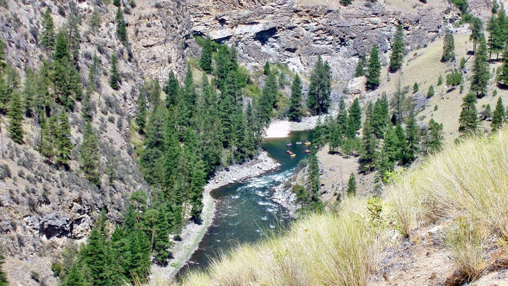
You want the middle of nowhere? The Frank Church River of No Return Wilderness, in Idaho, is that and then some. The wilderness comprises 2.3 million acres, making it one of the largest roadless areas in the lower 48 (only Death Valley Wilderness is bigger). With two major whitewater rivers—the Salmon and the Middle Fork of the Salmon—flowing through the Frank Church, the best way to explore this vastness is by raft.
Let’s focus on the Middle Fork, which slices through the heart of the roadless area for 104 miles, from its source at the confluence of Bear Valley and Marsh Creeks to its convergence with the Salmon. Many consider this to be the best river trip in the country, thanks to the scenery (the waterway rolls through a landscape full of 10,000-foot peaks, vertical cliffs, and thick Douglas fir) and the adrenaline rush (100 rapids, from class III to class IV, in 100 miles).
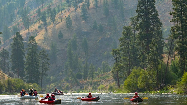
Thousands of people paddle the Middle Fork every summer. Fortunately, the river is managed for its wilderness quality, with only seven group launches allowed per day during the summer and a 30-person max for commercial trips. During the week-long trip, you’ll camp on the beaches, see Native American artifacts like petroglyphs and pottery left by the Nez Perce and Shoshone-Bannock tribes, and soak in hot springs.
The most out-there you’ll feel is 80 miles into the trip, paddling into Impassable Canyon, a narrow, steep-walled gorge packed with big rapids. Shortly after entering the canyon, eddy out and take a quick side hike to Veil Falls, a waterfall that drops into a cave-like amphitheater.
How to Get There: Most boaters and commercial trips put in at Indian Creek and take out at Cache Bar, after the rivers converge. OARS offers six-day trips on the whole river ($3,599 per person) with catered meals. If you want to lead your own group, apply for a permit, to be assigned via a random lottery ($6 reservation fee and $4 per person per day recreation fee). Applications for lottery permits to raft between May 28 and September 3 are accepted from December 1 to January 31, with results announced on February 14.
7. Remote Hike
100-Mile Wilderness, Maine
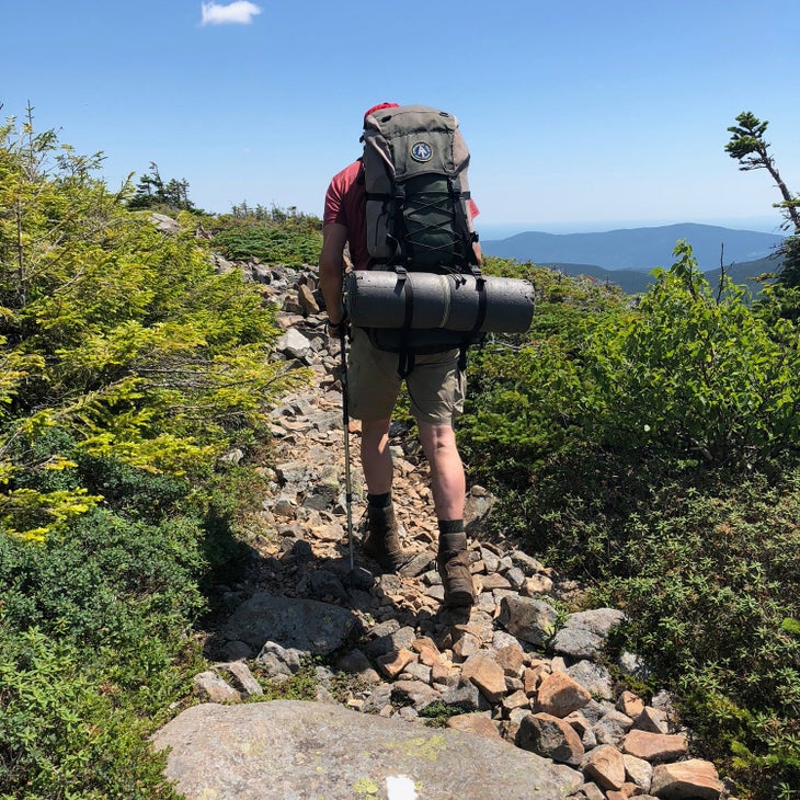
The 2,000-mile Appalachian Trail is legendary, but it’s not exactly remote, considering that it crosses roads and dips into towns along the Appalachian chain up the East Coast. The 100-Mile Wilderness section, in Maine, is an entirely different story, however, offering a stretch of trail interrupted only by the occasional forest road and fishing camp/hiker lodge.
Hike this piece of the A.T. from highway 15 to Abol Bridge in Baxter State Park if you want a bit of solitude, but be prepared to work for it. The route typically takes 10 days and features more than 20,000 feet of elevation gain up and over the Barren-Chairback and Whitecap Mountain Ranges. You’ll ford rivers and traverse ankle-turning scree. You can filter water along the way, but will need to carry your food, so count on a heavy pack, too.
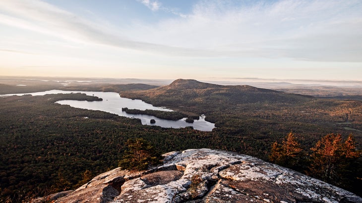
Cranberry bogs and isolated ponds punctuate the landscape of dense pine and hardwood forest, and you can see Lake Onawa from the rocky peak of Barren Mountain. As for fauna, you may well spot moose as you hike. You can add another 14 miles to the hike to tack on Katahdin (5,268 feet), Maine’s highest peak and the official end of the A.T.
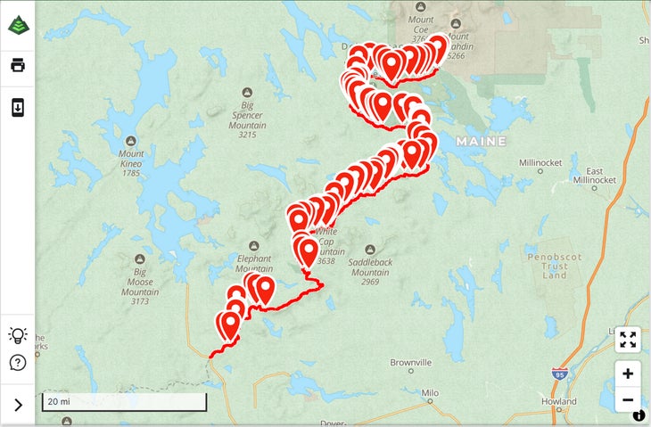
How to Get There: It’s easy to reach the southern end of the 100-Mile Wilderness; it’s located off highway 15 in Monson. But traversing the truly remote stretches of the A.T. through this stretch of wilderness is up to your legs and lungs. July is the best month, as the black flies have mostly disappeared and the north-bound thru-hikers haven’t showed up yet. Shaw’s Hiker Hostel in Monson offers shuttles and can arrange for food drops to lighten your load. The 100-Mile Wilderness isn’t completely devoid of civilization; the Appalachian Mountain Club operates a few lodges in the area, but you won’t see them from the trail.
8. Remote Surf Break
Santa Rosa Island, Channel Islands National Park, California
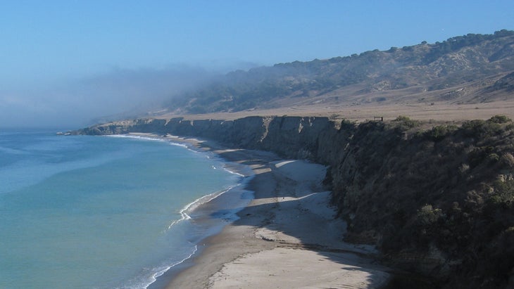
Channel Islands National Park protects five islands off the coast of Southern California, and all offer the kind of remote setting many of us crave after spending time in a generally populous region. While coming here is an effort, the 53,000-acre Santa Rosa Island promises secluded backcountry beach campsites on soft patches of sand tucked into coves and surrounded by cliffs and sea caves, with wilderness-style surfing where you’ll never have to wait in a lineup for a wave.
The only access is via boat. If you take the ferry operated by Island Packers (see below), you’ll be dropped off at a pier in Becher’s Bay. Just 1.5 miles from the pier is the 15-site Water Canyon Campground, with drinking water and shelter from the sun. There are even flush toilets. You could feasibly base out of here and day-hike to various beaches on the southern coast of Santa Rosa, where the surfing is the most consistent in summer. Water Canyon also has its own beach that extends from the pier to East Point for several miles during low tide.
But the best surfing is further south, as the coast picks up south-southwestern swells during the summer. There are breaks along the beaches starting at East Point and moving south down the coast. After a drop-off at the pier (see below), follow Coastal Road south from the pier for several miles through grassland and Torrey Pines until it wraps around East Point. This means carrying your surfboard and camping gear. You’ll see small beaches along the rugged coast that are open for camping between August 15 and December 31. Look for the high-tide line to determine which beach is safe for camping (and then pitch your tent way above that mark). Larger beaches are just another mile down the coast.
Santa Rosa offers loads of other adventures as well. The water is surprisingly clear compared to what you find off the mainland, so snorkeling is primo, with reefs and kelp forests hiding abalone and lobsters. And there’s no light pollution, so the night sky is popping.
How to Get There: If you have a friend with a boat, call in a favor, as you could cruise the 40 miles from SoCal to Santa Rosa and surf one of these remote breaks without needing to camp. Otherwise, catch a ferry with Island Packers (from $45 per person, one way) and get dropped off at Becher’s Bay and start hiking. Make sure you have a camping reservation in advance (from $15 per night), because you’ll need that to reserve a spot on the ferry.
9. Remote Safari
Mount Nkungwe, Tanzania
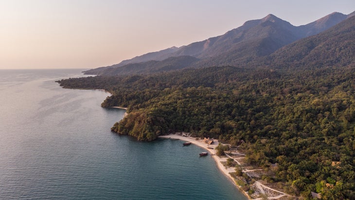
Africa is brimming with remote places, but Mahale Mountains National Park, in the western edge of Tanzania, has a special mix of isolation, exceptional wildlife, and beauty. There are no roads within the 632-square-mile park, so all travel is on foot, and Mahale occupies a peninsula jutting into the massive Lake Tanganyika, one of the largest lakes in the world, so the only way to reach it is by plane or a day-long boat ride.
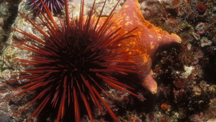
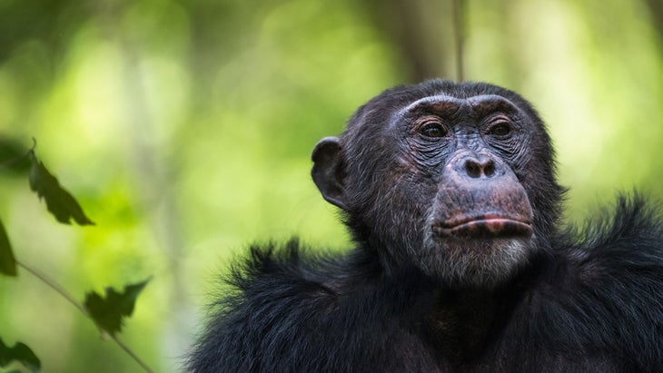
The park was established in 1985 to protect the world’s largest known population of chimpanzees, which today are thriving at 1,000-strong. It’s also one of the few places in the world where chimps and leopards share the same terrain. The park’s landscape quickly shifts from white sandy beaches on the shore of Tanganyika to dense forest and steep mountain slopes cloaked in mist.
Reaching the park alone is a feat, but if you really want to tick off a far-removed spot, climb Mount Nkungwe (8,077 feet), the tallest mountain inside the park’s borders. It’s a grueling 10-day hike, requiring that you go up and over two sub-peaks and gaining more than 6,000 feet in elevation to reach the summit. Most hikers break the trip up into three days, camping along the way. The views from the top are astounding—you can see all of the Mahale Mountains and Lake Tanganyika below—but the summit isn’t the real highlight of this journey. In addition to chimpanzees, you’ll have the chance to see elephants, giraffes, and buffalo, not to mention the red colobus monkeys that live in the higher elevations of the park.
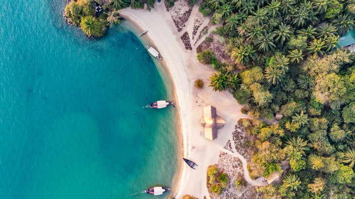
How to Get There: The fastest way to reach Mahale Mountains National Park is by plane, but most people arrive by boat. It’s easy to charter a boat from the town of Kigoma, and speedboats make the journey in four hours. Greystoke Mahale Camp, a six-tent luxury property on the white sands of Tanganyika, is the most popular place to stay, especially since a family of chimps lives in the jungle nearby (from $2,250 a night during high season between June and September, all inclusive). Published fees to enter the park are $40 per person, but reports from some previous visitors indicate the price fluctuates. All hikes require accompaniment by a ranger. Reach out to the park directly for timing, fees, and other information.
10. Remote Dunes
Athabasca Sand Dunes Provincial Park, Saskatchewan, Canada
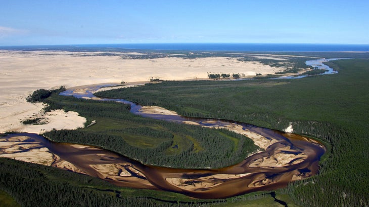
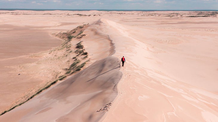
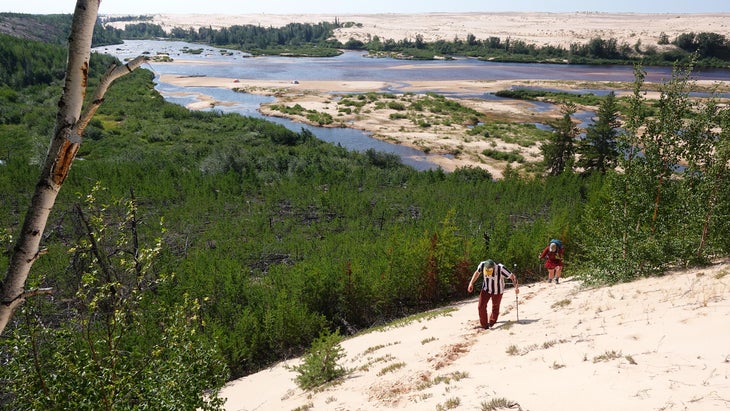
The Athabasca Sand Dunes Provincial Park covers 62 miles of sand dunes in far north Saskatchewan. These are the most northerly sand dunes on the planet—a slice of the Sahara in the midst of Canada’s boreal forest. But unlike the Sahara, Athabasca, which is flanked by a large lake and dissected by three rivers, has plenty of fresh water.
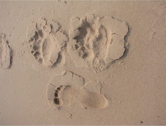
You can only reach the dunes by float plane or boat, and there are no services within the park. No roads, no cell service, no rangers or structures, so be prepared to take care of yourself in a wilderness setting. Head to the William River Dune field, where the longest, largest dunes are. Land on the shore of Thomson Bay and hike west across the smaller Thomson Bay Dune Field for four miles to the Williams River. If the water’s low enough, you can wade over to explore the largest dunes in the park. You can camp for free within the park from Memorial Day to Labor Day.
How to Get There: Stony Rapids, on the eastern edge of Lake Athabasca, is the closest gateway town, though 90 miles east of the dunes. It has a float-plane base, making chartering a plane easy (but not cheap). Fly to Thomson Bay and start hiking west. Churchill River Canoe Outfitters offers a guided six-day backpacking adventure that includes the flight into the park from Fort McMurray ($3,900 per person).
11. Remote Mountain Peak
Mount Khuiten, Mongolia
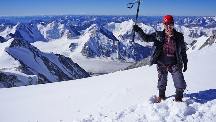
A trip up Mount Khuiten (14,350 feet), the tallest peak in Mongolia, presents experiences in both solitude and culture. Khuiten sits in the heart of Altai Tavan Bogd National Park, which preserves 6,362 square miles of lakes, glaciers, and snow-capped mountains in western Mongolia. Altai is one of those places where you want to have a good map and a local guide, because if you get lost here, you could end up in either China or Russia (the park shares a border with both countries). This is a dream trip but a demanding one, so be experienced and prepared, and arrive fit and with top-flight warm gear. See below for intel on finding a guide.
The park encompasses groupings of petroglyphs and burial sites that illustrate the development of Mongolian nomadic culture over a 12,000-year time period, earning the area UNESCO World Heritage status. You have the chance to see some of these petroglyphs on the multi-day journey to the summit of Khuiten. You’ll also see modern-day nomadic culture, as the road into the park passes communities in traditional yurts.
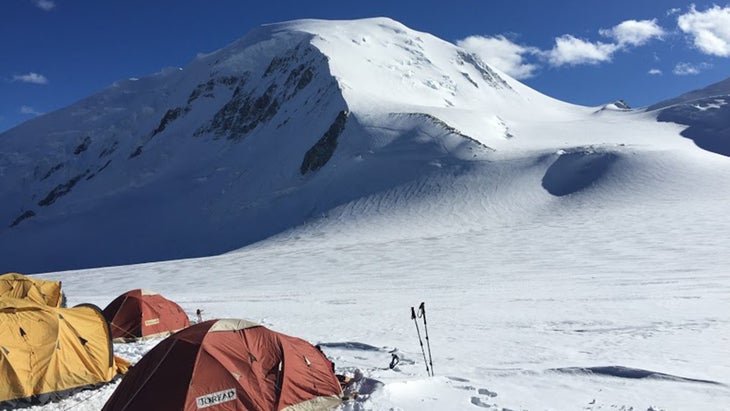
As for the approach, the 10-mile trek from the edge of the park to basecamp ends at the 8.5-mile-wide Potanin Glacier, with camels to carry your gear. Most people climb the smaller sister mountain, Malchin Peak, to acclimatize to the altitude before navigating the crevasses of Potanin Glacier to High Camp on the edge of Khuiten. The final push to the top of Mount Khuiten is 3,000 feet up steep, snow-covered slopes requiring crampons, ice axes, and ropework. The view from the snow-capped summit encompasses all of the Altai Mountains as you gaze down on three countries: Mongolia, China, and Russia.
How to Get There: Fly into UlaanBaatar, Mongolia, and take a domestic puddle jumper to the village of Olgii, on the edge of the park. From there, it’s a six-hour drive over rough roads to the ranger station just inside the park. Next you’re on foot for days, depending on how much you want to acclimate, before your summit bid. The trek requires mountaineering skills and local knowledge, so hire a guide. Discover Altai is a trekking company owned by locals that offers a variety of expeditions on and around Khuiten (from $2,600 per person).
How to Be a Conscientious Visitor
Keep in mind some basic rules when you’re traveling to these far-flung locales. Follow Leave No Trace principles, taking everything you brought to the destination back home when you leave. Respect local cultures and customs, and learn about whose land you’re on. Whenever possible, stay in a lodge where the money goes directly to local entrepreneurs, and use local guides and services. Buy something if you can afford it. Always protect the wildlife and natural environment, which means keeping your distance and minimizing your impact.
Graham Averill is Outside magazine’s national parks columnist. If he has to choose between a remote beach and a remote mountaintop, it’s going to be sand and surf every time.
For more by Graham Averill, see: